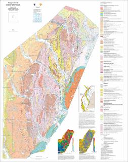
Berggrunnskart, Kongsberg litotektoniske enhet, Kongsberg - Modum - Hønefoss M 1:100 000
| dc.contributor.author | Viola, G. | |
| dc.contributor.author | Bingen, B. | |
| dc.contributor.author | Solli, A. | |
| dc.coverage.spatial | 17144 Flesberg | |
| dc.coverage.spatial | 17143 Notodden | |
| dc.coverage.spatial | 17142 Kongsberg | |
| dc.coverage.spatial | RINGERIKE | |
| dc.coverage.spatial | MODUM | |
| dc.coverage.spatial | VIKEN | |
| dc.coverage.spatial | VESTFOLD | |
| dc.coverage.spatial | TELEMARK | |
| dc.coverage.spatial | KONGSBERG | |
| dc.coverage.spatial | ØVRE EIKER | |
| dc.coverage.spatial | FLESBERG | |
| dc.coverage.spatial | HOLMESTRAND | |
| dc.coverage.spatial | 18153 Hønefoss | |
| dc.coverage.spatial | 18144 Lier | |
| dc.date.accessioned | 2020-07-09T11:48:55Z | |
| dc.date.available | 2020-07-09T11:48:55Z | |
| dc.date.issued | 2016 | |
| dc.identifier.uri | https://hdl.handle.net/11250/2661770 | |
| dc.language.iso | nor | |
| dc.rights | Navngivelse 4.0 Internasjonal | |
| dc.rights.uri | http://creativecommons.org/licenses/by/4.0/deed.no | |
| dc.subject | BERGGRUNNSGEOLOGI | |
| dc.subject | TEKTONIKK | |
| dc.subject | MANGETOMETRI | |
| dc.subject | BERGART | |
| dc.title | Berggrunnskart, Kongsberg litotektoniske enhet, Kongsberg - Modum - Hønefoss M 1:100 000 | |
| dc.type | Map | |
| dc.description.localcode | 64224 | |
| dc.source.pagenumber | 1 kart |
Files in this item
This item appears in the following Collection(s)
-
Kart [1000]
NGUs trykte kart

Except where otherwise noted, this item's license is described as Navngivelse 4.0 Internasjonal