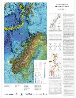
Neotectonic map, Norway and adjacent areas. Scale 1:3 mill.
| dc.contributor.author | Olesen, O. | |
| dc.contributor.author | Riis, F. | |
| dc.contributor.author | Lindholm, C.D. | |
| dc.contributor.author | Dehls, J.F. | |
| dc.contributor.author | Hicks, E.C. | |
| dc.contributor.author | Bungum, H. | |
| dc.date.accessioned | 2020-07-09T13:54:08Z | |
| dc.date.available | 2020-07-09T13:54:08Z | |
| dc.date.issued | 2000 | |
| dc.identifier.uri | https://hdl.handle.net/11250/2662103 | |
| dc.language.iso | eng | |
| dc.rights | Navngivelse 4.0 Internasjonal | |
| dc.rights.uri | http://creativecommons.org/licenses/by/4.0/deed.no | |
| dc.subject | LANDHEVNING | |
| dc.subject | FORKASTNING | |
| dc.subject | NEOTEKTONIKK | |
| dc.subject | SEISMOLOGI | |
| dc.subject | SKRED | |
| dc.title | Neotectonic map, Norway and adjacent areas. Scale 1:3 mill. | |
| dc.type | Map | |
| dc.description.localcode | 63479 |
Tilhørende fil(er)
Denne innførselen finnes i følgende samling(er)
-
Kart [1000]
NGUs trykte kart

Med mindre annet er angitt, så er denne innførselen lisensiert som Navngivelse 4.0 Internasjonal