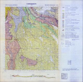
Kvænangsbotn. Berggrunnskart; Kvænangsbotn; 17342; 1:50 000; sort/hvitt;
| dc.contributor.author | Zwaan, Klaas Bouke | |
| dc.coverage.spatial | 17342 Kvænangsbotn | |
| dc.coverage.spatial | NORDREISA | |
| dc.coverage.spatial | KVÆNANGEN | |
| dc.date.accessioned | 2020-07-09T14:24:36Z | |
| dc.date.available | 2020-07-09T14:24:36Z | |
| dc.date.issued | 1974 | |
| dc.identifier.uri | https://hdl.handle.net/11250/2663488 | |
| dc.language.iso | nor | |
| dc.rights | Navngivelse 4.0 Internasjonal | |
| dc.rights.uri | http://creativecommons.org/licenses/by/4.0/deed.no | |
| dc.subject | BERGGRUNNSGEOLOGI | |
| dc.title | Kvænangsbotn. Berggrunnskart; Kvænangsbotn; 17342; 1:50 000; sort/hvitt; | |
| dc.type | Map | |
| dc.description.localcode | 36551 |
Tilhørende fil(er)
Denne innførselen finnes i følgende samling(er)
-
Kart [1000]
NGUs trykte kart

