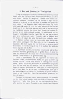
Ras ved Jonsrud på Feiringveien.
| dc.contributor.author | Holmsen, Gunnar | |
| dc.coverage.spatial | 19162 Tangen | |
| dc.date.accessioned | 2020-08-26T12:39:37Z | |
| dc.date.available | 2020-08-26T12:39:37Z | |
| dc.date.issued | 1946 | |
| dc.identifier.uri | https://hdl.handle.net/11250/2674563 | |
| dc.description.abstract | In the vicinity of Jonsrud on the beach of lake Mjøsa, the road is built in a steep slope about 30 m above the level. Here the road surveyor in the autumn of 1935 observed fissures through the ground. On the 23rd of September a dislocation of 10 cm was visible along a crevice. The following days the road sunk over a distance of 50 m, and a great flake of firm calyey ground slid down the sttep slopeeep slope. The flake broke into smaller pieces. At the inside of the road the sliding flake was limited by a vertical crevice. Here a sounding to a deep of 6 m was made, but no variation in the stability of the ground was found. Neither was weak ground discovered anywhere else, by means of sounding and digging. At the foot of the slope, just at the beach of the lake, a wall of plastic, clayey gravel was raised. The road was repaired by filling up the sunken part, combined with a piling of the ground, but a new sinking appeared on Jan. 11th the next year. At last, after removing part of the slope above the road, the repair was effective. | |
| dc.language.iso | nor | |
| dc.relation.ispartofseries | NGU (166) | |
| dc.rights | Navngivelse 4.0 Internasjonal | |
| dc.rights.uri | http://creativecommons.org/licenses/by/4.0/deed.no | |
| dc.subject | LEIR | |
| dc.subject | AVSETNING | |
| dc.subject | SKREDAVSETNING | |
| dc.subject | SKREDFORM | |
| dc.subject | BORING | |
| dc.subject | GEOTEKNIKK | |
| dc.title | Ras ved Jonsrud på Feiringveien. | |
| dc.type | Journal article | |
| dc.description.localcode | 36329 | |
| dc.source.pagenumber | 10-12 |
Tilhørende fil(er)
Denne innførselen finnes i følgende samling(er)
-
Artikler [1064]
Artikler fra seriene NGU, NGU Bulletin og NGU Skrifter

Med mindre annet er angitt, så er denne innførselen lisensiert som Navngivelse 4.0 Internasjonal