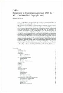
| dc.description.abstract | The superficial deposits and their morphological features within the map-sheet Dokka, 1816 IV, in central south-eastern Norway are classified and described. Ice movements and the course of deglaciation are reconstucted. The superficial deposits are dominated by till which on the map is devided into thick and thin cover. The lithology of the lodgement till is dominated by the local Eocambrian rocks. Five glaciation phases are reconsructed on the basis of glacial striae. The first phase was that of valley glaciers flowing from the mountains in the north-west. The next three phases were characterized by inland ice moving towards the southeast, the south, and lastly towards the east. The youngest striae reveal the existence of local ice caps. During the deglaciation the meltwater was directed by the ice, first through Snertingdalen towards lake MjThe superficial deposits and their morphological features within the map-sheet Dokka, 1816 IV, in central south-eastern Norway are classified and described. Ice movements and the course of deglaciation are reconstucted. The superficial deposits are dominated by till which on the map is devided into thick and thin cover. The lithology of the lodgement till is dominated by the local Eocambrian rocks. Five glaciation phases are reconsructed on the basis of glacial striae. The first phase was that of valley glaciers flowing from the mountains in the north-west. The next three phases were characterized by inland ice moving towards the southeast, the south, and lastly towards the east. The youngest striae reveal the existence of local ice caps. During the deglaciation the meltwater was directed by the ice, first through Snertingdalen towards lake Mjøsa, then via the Landås river to lake Randsfjorden. The meltwater drainage of deglaciation is manifested by numerous meltwater channels, eskers and subglacial fans at the mouths of the rivers Landås and Dokka. Analyses of grain-size distribution and lithology of the superficial deposits are given. Geochemical analyses have also been carried out on these deposits. | |

