Lerfall på Fallaksøy, Nedre Eiker.
| dc.contributor.author | Holmsen, Gunnar | |
| dc.coverage.spatial | 18143 Drammen | |
| dc.date.accessioned | 2020-08-26T12:39:45Z | |
| dc.date.available | 2020-08-26T12:39:45Z | |
| dc.date.issued | 1946 | |
| dc.identifier.uri | https://hdl.handle.net/11250/2674569 | |
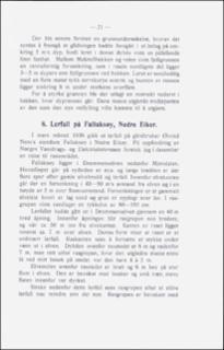
| dc.description.abstract | This landslip occurred in March 1936. Fallaksøy island is situated in the Drammen river between Mjøndalen and Drammen. The landslip broke into the river through a 40 m broad opening. Inside the opening the slided area widens. The limit of the slip is 50 m from the river bank and 7 m above the river level. The profile shows a layer of sand 80-150 cm deep on top of the clay deposit. Close by is seen the hollow of a landslip which took place 30 years ago. The steeps of the Drammen river have repeatedly been damaged by wounds resultings in landslips. Probably the stream's excavation in an unusually weak river bed occasioned the landslip at Fallaksøy. | |
| dc.language.iso | nor | |
| dc.relation.ispartofseries | NGU (166) | |
| dc.rights | Navngivelse 4.0 Internasjonal | |
| dc.rights.uri | http://creativecommons.org/licenses/by/4.0/deed.no | |
| dc.subject | AVSETNING | |
| dc.subject | LEIR | |
| dc.subject | SKREDFORM | |
| dc.subject | SAND | |
| dc.subject | MEKTIGHET | |
| dc.subject | SKREDAVSETNING | |
| dc.title | Lerfall på Fallaksøy, Nedre Eiker. | |
| dc.type | Journal article | |
| dc.description.localcode | 34875 | |
| dc.source.pagenumber | 21-22 |
Tilhørende fil(er)
Denne innførselen finnes i følgende samling(er)
-
Artikler [1064]
Artikler fra seriene NGU, NGU Bulletin og NGU Skrifter

Med mindre annet er angitt, så er denne innførselen lisensiert som Navngivelse 4.0 Internasjonal