| dc.contributor.author | Holmsen, Per | |
| dc.coverage.spatial | 17231 Overhalla | |
| dc.date.accessioned | 2020-08-26T12:39:51Z | |
| dc.date.available | 2020-08-26T12:39:51Z | |
| dc.date.issued | 1946 | |
| dc.identifier.uri | https://hdl.handle.net/11250/2674572 | |
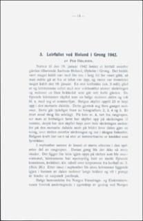
| dc.description.abstract | On january 19th, 1942 a violent clay-slide took place near the farm Holund in Grong district, east of Namsos. The size of the displaced area was about 1 acre. A heavy wave of liquid clay rushed down into a small valley. It washed up the slope to level 25 m high, was then reflected, this being repeated 3 or 4 times. In September the same year a new slide took place in connection with the first one. The slide by Holund took place in a typical \"kvikkleir\" deposit. In May 1943 the author took a visit to Holund. Undisturbed samples were taken after the Swedish method (1). A calculation was made on the stability of another clayey hillslide, and a sketch map was made over the area. The clay-slide by Holund was due to the natural meta-stability of the \"kvikkleir\" deposit. Good descriptions of this type of slay-slides is given by Gunnar Holmsen. | |
| dc.language.iso | nor | |
| dc.relation.ispartofseries | NGU (167) | |
| dc.rights | Navngivelse 4.0 Internasjonal | |
| dc.rights.uri | http://creativecommons.org/licenses/by/4.0/deed.no | |
| dc.subject | LEIR | |
| dc.subject | AVSETNING | |
| dc.subject | SKREDAVSETNING | |
| dc.subject | SKREDFORM | |
| dc.subject | KVIKKLEIRE | |
| dc.subject | GEOLOGISK RISIKO | |
| dc.title | Leirfall ved Holund i Grong 1942. | |
| dc.type | Journal article | |
| dc.description.localcode | 35585 | |
| dc.source.pagenumber | 14-25 | |

