| dc.contributor.author | Holmsen, Per | |
| dc.coverage.spatial | 17241 Foldereid | |
| dc.date.accessioned | 2020-08-26T12:40:14Z | |
| dc.date.available | 2020-08-26T12:40:14Z | |
| dc.date.issued | 1946 | |
| dc.identifier.uri | https://hdl.handle.net/11250/2674580 | |
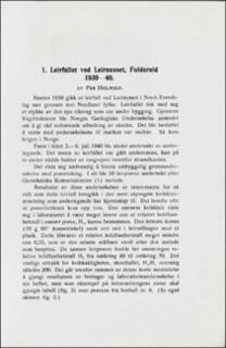
| dc.description.abstract | In the autumn of 1930 a clay-slide took place near Foldereid, Northern Norway. Part of the cross country road to Nordland was touched by the slide. In order to reconstruct the road traverse, borings and ground studies were carried out by the present author after the Swedish method (1). The field work was made between the 3rd and the 9th of July 1940, and the laboratory work was made in Oslo shortly afterwards. The studies were interesting, this clay deposit being the most typically \"kvikkleire\" deposit the author ever saw. In most cases the totally stirred clay samples were nearly as liquid as water. Geotechnical data of the clay samples are given from the series in locality no. 6 (see table fig. 3). This slide is supposed to be due to a new part of the road embankment on ground too soft to carry its weight. | |
| dc.language.iso | nor | |
| dc.relation.ispartofseries | NGU (167) | |
| dc.rights | Navngivelse 4.0 Internasjonal | |
| dc.rights.uri | http://creativecommons.org/licenses/by/4.0/deed.no | |
| dc.subject | AVSETNING | |
| dc.subject | LEIR | |
| dc.subject | SKREDAVSETNING | |
| dc.subject | SKREDFORM | |
| dc.subject | KVIKKLEIRE | |
| dc.subject | GEOLOGISK RISIKO | |
| dc.title | Leirfall ved Leirnesset, Foldereid 1939-40. | |
| dc.type | Journal article | |
| dc.description.localcode | 36037 | |
| dc.source.pagenumber | 7-11 | |

