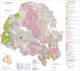
Kart over berggrunnen i Vinje kommune målestokk 1:100 000
| dc.contributor.author | Sigmond, E. | |
| dc.coverage.spatial | 15142 Åmotsdal | |
| dc.coverage.spatial | 15141 Frøystaul | |
| dc.coverage.spatial | 15153 Lågaros | |
| dc.coverage.spatial | 14152 Nordmannslågen | |
| dc.coverage.spatial | 14144 Haukelisæter | |
| dc.coverage.spatial | 15144 Møsstrand | |
| dc.coverage.spatial | 14141 Songavatnet | |
| dc.coverage.spatial | 14142 Sæsvatn | |
| dc.coverage.spatial | 15143 Vinje | |
| dc.date.accessioned | 2020-07-09T11:43:12Z | |
| dc.date.available | 2020-07-09T11:43:12Z | |
| dc.date.issued | 2018 | |
| dc.identifier.uri | https://hdl.handle.net/11250/2661698 | |
| dc.language.iso | nor | |
| dc.rights | Navngivelse 4.0 Internasjonal | |
| dc.rights.uri | http://creativecommons.org/licenses/by/4.0/deed.no | |
| dc.subject | BERGGRUNNSGEOLOGI | |
| dc.subject | BERGART | |
| dc.subject | KALEDONSKE FJELLKJEDE | |
| dc.title | Kart over berggrunnen i Vinje kommune målestokk 1:100 000 | |
| dc.type | Map | |
| dc.description.localcode | 66309 | |
| dc.source.pagenumber | 1 kart |
Files in this item
This item appears in the following Collection(s)
-
Kart [1000]
NGUs trykte kart

Except where otherwise noted, this item's license is described as Navngivelse 4.0 Internasjonal