Neotectonic map of Norway and adjacent areas scale 1:3 000 000
| dc.contributor.author | Keiding, M. | |
| dc.contributor.author | Dehls, J. | |
| dc.contributor.author | Olesen, O. | |
| dc.date.accessioned | 2020-07-09T11:43:17Z | |
| dc.date.available | 2020-07-09T11:43:17Z | |
| dc.date.issued | 2018 | |
| dc.identifier.uri | https://hdl.handle.net/11250/2661700 | |
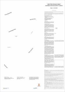
| dc.description.abstract | Neotektonikk er studiet av bevegelser og deformasjon av jordskorpen, som er nåværende eller nyere i geologisk tid. Kartet viser jordskjelv, fokalmekanismer, spenningsmålinger, postglasiale forkastninger, landhevning, submarine skred, vulkaner, oppløft\/erosjon og sedimentavleiring i det norske område. (Neotectonics is the study of motion and deformation of Earth's crust that are current or recent in geological time. The map displays earthquakes, focal mechanisms, stress observations, postglacial faults, glacial isostatic adjustment, submarine slides, volcanoes, uplift\/erosion and sediment deposition in Norway and adjacent areas.) Kartet også vedlagt i NGU-rapport 2018.010 | |
| dc.language.iso | eng | |
| dc.rights | Navngivelse 4.0 Internasjonal | |
| dc.rights.uri | http://creativecommons.org/licenses/by/4.0/deed.no | |
| dc.subject | SEISMOLOGI | |
| dc.subject | GEOFYISIKK | |
| dc.subject | TEKTONIKK | |
| dc.subject | NEOTEKTONIKK | |
| dc.subject | KVARTÆR | |
| dc.subject | NEOGEN | |
| dc.subject | VULKANOLOGI | |
| dc.title | Neotectonic map of Norway and adjacent areas scale 1:3 000 000 | |
| dc.type | Map | |
| dc.description.localcode | 66307 | |
| dc.source.pagenumber | 1 kart |
Files in this item
This item appears in the following Collection(s)
-
Kart [1000]
NGUs trykte kart

Except where otherwise noted, this item's license is described as Navngivelse 4.0 Internasjonal