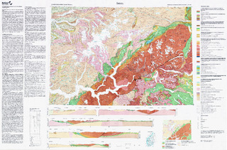
Årdal. Berggrunnskart Årdal M 1:250 000; trykt i farger
| dc.contributor.author | Lutro, Ole | |
| dc.contributor.author | Tveten, Einar | |
| dc.coverage.spatial | LUSTER | |
| dc.coverage.spatial | VESTLAND | |
| dc.coverage.spatial | INNLANDET | |
| dc.coverage.spatial | VIKEN | |
| dc.coverage.spatial | STAD | |
| dc.coverage.spatial | VOLDA | |
| dc.coverage.spatial | GLOPPEN | |
| dc.coverage.spatial | STRYN | |
| dc.coverage.spatial | SUNNFJORD | |
| dc.coverage.spatial | SOGNDAL | |
| dc.coverage.spatial | HØYANGER | |
| dc.coverage.spatial | VIK | |
| dc.date.accessioned | 2020-07-09T13:58:10Z | |
| dc.date.available | 2020-07-09T13:58:10Z | |
| dc.date.issued | 1996 | |
| dc.identifier.uri | https://hdl.handle.net/11250/2662180 | |
| dc.description.abstract | Beskrivelsen finnes på kartet. | |
| dc.language.iso | nor | |
| dc.rights | Navngivelse 4.0 Internasjonal | |
| dc.rights.uri | http://creativecommons.org/licenses/by/4.0/deed.no | |
| dc.subject | BERGGRUNNSGEOLOGI | |
| dc.title | Årdal. Berggrunnskart Årdal M 1:250 000; trykt i farger | |
| dc.type | Map | |
| dc.description.localcode | 43820 | |
| dc.source.pagenumber | 1 kart |
Files in this item
This item appears in the following Collection(s)
-
Kart [1000]
NGUs trykte kart

Except where otherwise noted, this item's license is described as Navngivelse 4.0 Internasjonal