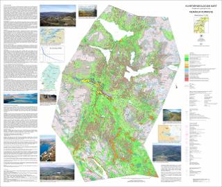
Kvartærgeologisk kart Meråker kommune M 1:70 000 med beskrivelse
| dc.contributor.author | Reite, A.J. | |
| dc.contributor.author | Sveian, H. | |
| dc.coverage.spatial | 17211 Meråker | |
| dc.date.accessioned | 2022-03-09T10:36:44Z | |
| dc.date.available | 2022-03-09T10:36:44Z | |
| dc.date.issued | 2021 | |
| dc.identifier.uri | https://hdl.handle.net/11250/2983954 | |
| dc.language.iso | nor | |
| dc.publisher | Norges geologiske undersøkelse | |
| dc.rights | Navngivelse 4.0 Internasjonal | |
| dc.rights.uri | http://creativecommons.org/licenses/by/4.0/deed.no | |
| dc.subject | LØSMASSE | |
| dc.subject | KORNSTØRRELSE | |
| dc.subject | BREBEVEGELSE | |
| dc.subject | GEOMORFOLOGI | |
| dc.subject | KVARTÆRGEOLOGI | |
| dc.title | Kvartærgeologisk kart Meråker kommune M 1:70 000 med beskrivelse | |
| dc.type | Map | |
| dc.description.localcode | 67229 | |
| dc.source.pagenumber | 1 kart |
Files in this item
This item appears in the following Collection(s)
-
Kart [1000]
NGUs trykte kart

Except where otherwise noted, this item's license is described as Navngivelse 4.0 Internasjonal