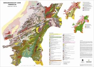
Berggrunnskart over Trøndelag : målestokk 1 : 400 000
| dc.contributor.author | Arntsen, Mari Lie | |
| dc.contributor.author | Gunnleiksrud, Ida Hilde | |
| dc.contributor.author | Torgersen, Espen | |
| dc.contributor.author | Nordgulen, Øystein | |
| dc.contributor.author | Ksienzyk, Anna | |
| dc.contributor.author | Meyer, Gurli | |
| dc.contributor.author | Gasser, Deta | |
| dc.contributor.author | Rasmussen, Mads Chalmer | |
| dc.date.accessioned | 2022-03-29T05:35:26Z | |
| dc.date.available | 2022-03-29T05:35:26Z | |
| dc.date.issued | 2022 | |
| dc.identifier.uri | https://hdl.handle.net/11250/2988135 | |
| dc.language.iso | nor | |
| dc.publisher | Norges geologiske undersøkelse | |
| dc.rights | Navngivelse 4.0 Internasjonal | |
| dc.rights.uri | http://creativecommons.org/licenses/by/4.0/deed.no | |
| dc.subject | BERGGRUNNSGEOLOGI | |
| dc.subject | BERGART | |
| dc.title | Berggrunnskart over Trøndelag : målestokk 1 : 400 000 | |
| dc.type | Map | |
| dc.description.localcode | 67648 |
Files in this item
This item appears in the following Collection(s)
-
Kart [1000]
NGUs trykte kart

Except where otherwise noted, this item's license is described as Navngivelse 4.0 Internasjonal