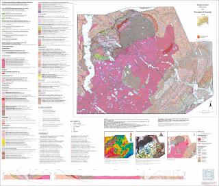
Foreløpig berggrunnskart Drangedal og Nissedal M 1:75 000. Bedrock map Drangedal and Nissedal 1:75 000
| dc.contributor.author | Svendby, A.K. | |
| dc.contributor.author | Gunleiksrud, I. | |
| dc.contributor.author | Torgersen, E. | |
| dc.contributor.author | Bingen, B. | |
| dc.contributor.author | Henderson, I.H.C. | |
| dc.contributor.author | Nasuti, A. | |
| dc.contributor.author | Baranwal, V.C. | |
| dc.coverage.spatial | 16132 Drangedal | |
| dc.coverage.spatial | 16121 Gjerstad | |
| dc.coverage.spatial | DRANGEDAL | |
| dc.coverage.spatial | 16124 Vegår | |
| dc.coverage.spatial | 16134 Seljord | |
| dc.coverage.spatial | 16131 Bø | |
| dc.coverage.spatial | 17133 Kilebygd | |
| dc.coverage.spatial | NISSEDAL | |
| dc.coverage.spatial | 16133 Nissedal | |
| dc.date.accessioned | 2022-12-07T08:35:05Z | |
| dc.date.available | 2022-12-07T08:35:05Z | |
| dc.date.issued | 2022 | |
| dc.identifier.uri | https://hdl.handle.net/11250/3036254 | |
| dc.language.iso | nor | |
| dc.publisher | Norges geologiske undersøkelse | |
| dc.rights | Navngivelse 4.0 Internasjonal | |
| dc.rights.uri | http://creativecommons.org/licenses/by/4.0/deed.no | |
| dc.subject | BERGART | |
| dc.subject | BERGGRUNNSGEOLOGI | |
| dc.subject | DATERING | |
| dc.subject | STRATIGRAFI | |
| dc.title | Foreløpig berggrunnskart Drangedal og Nissedal M 1:75 000. Bedrock map Drangedal and Nissedal 1:75 000 | |
| dc.type | Map | |
| dc.description.localcode | 68349 | |
| dc.source.pagenumber | 1 kart |
Files in this item
This item appears in the following Collection(s)
-
Kart [1000]
NGUs trykte kart

Except where otherwise noted, this item's license is described as Navngivelse 4.0 Internasjonal