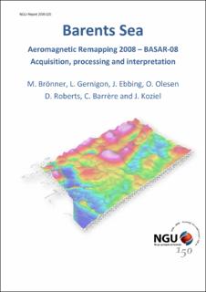
| dc.contributor.author | Brönner, Marco | |
| dc.contributor.author | Koziel, Janusz | |
| dc.contributor.author | Barrère, Cecile | |
| dc.contributor.author | Roberts, David | |
| dc.contributor.author | Olesen, Odleiv | |
| dc.contributor.author | Ebbing, Jörg | |
| dc.contributor.author | Gernigon, Laurent | |
| dc.date.accessioned | 2020-07-15T07:42:09Z | |
| dc.date.available | 2020-07-15T07:42:09Z | |
| dc.date.issued | 2009 | |
| dc.identifier.issn | 0800-3416 | |
| dc.identifier.uri | https://hdl.handle.net/11250/2664678 | |
| dc.description.abstract | A high sensitivity aeromagnetic survey, BASAR-08, was carried out in an area of 80,600 km2 in the Norwegian Barents Sea. Data processing comprised spike-removal and data editing, systematic corrections, statistical, and micro-levelling. Processing and interpretation of the new dataset included a reprocessing of the BAS-06 survey, covering the eastern Norwegian Barents Sea and the entire undisputed part fo the Nordkapp Basin. Several potential field maps were produced from the survey area. Examples of various filters applied to the magnetic field have been illustrated. A depth-to-magnetic source was calculated, applying Euler deconvolution techniques\rStructural interpretation of the new magnetic data and 2D modelling along three regional seismic lines was carried out in conjunction with the existing gravity data. An existing 3D model of the Norwegian Barents Sea was updated and readjusted to the new magnetic data. The new and reprocessed magnetic data are an important and beneficial improvement of the Norwegian shelf magnetic map, reflecting the regional basement settings with significant higher accuracy and giving new insights in the propagation of the Caledonides and the complex development of the southern Barents Sea. High frequency anomalies from shallower structures were utilized to get a comprehensive overview of the distribution of dykes and salt diapirism in the area and were helpful to link and identify geological structures offsore by onshore-offshore correlations. Grav\/Mag 2D and 3D modelling gave additional information of both the depth-to-basement deeper crustal setting and crustal thickness. | |
| dc.language.iso | eng | |
| dc.relation.ispartofseries | NGU-Rapport (2009.020) | |
| dc.rights | Navngivelse 4.0 Internasjonal | |
| dc.rights.uri | http://creativecommons.org/licenses/by/4.0/deed.no | |
| dc.subject | GEOFYSIKK | |
| dc.subject | BERGGRUNNSGEOLOGI | |
| dc.subject | KONTINENTALSOKKEL | |
| dc.subject | MAGNETOMETRI | |
| dc.title | Barents Sea Aeromagnetic Remapping BASAR-08 – Acquisition, processing and interpretation | |
| dc.type | Report | |
| dc.description.localcode | 54981 | |
| dc.source.pagenumber | 150 s. | |
| dc.relation.project | (323600) BASAR-08 Barents Sea Aeromagnetic Remapping 2008 | |

